Fall foliage drives from Greenville, and when to take them
Where the color actually is, the route up US 276, and why no park can give you an exact peak date.

Quick answers
- When does fall color peak in the South Carolina Upstate?
- There is no single date. The National Park Service says color starts at the Blue Ridge Parkway's highest elevations as early as late September, then spreads down the mountainside through October as lower elevations take their turn. Caesars Head sits at 3,208 feet, well below the parkway's named peaks, so its color generally follows later in that same progression, and neither the Park Service nor the state parks will name an exact week.
- Where can you see fall color near Greenville without a long hike?
- Caesars Head State Park's main overlook is a short walk from the parking area and looks out over the Blue Ridge Escarpment into North Carolina and Georgia. Discover South Carolina also lists Bald Rock, about five miles further up US 276, as an easy, mostly flat walk to a wide view, and Sassafras Mountain, the state's highest point, with a paved path to its observation tower.
- What is the drive from Greenville to Caesars Head State Park like?
- US 276 runs north out of Greenville through Travelers Rest and Marietta, then climbs into the Blue Ridge foothills to Caesars Head State Park on the Geer Highway. The road gains real elevation on the way up, which is exactly why the color at the top can still be green while Greenville's is turning, or past peak while Greenville is just starting.
- Do South Carolina's mountain state parks charge to get in?
- Yes. Caesars Head, Table Rock and Jones Gap are all part of the fee-supported trail system, with a modest per-person charge at the trailhead and discounts for South Carolina seniors and children. None of the three overlooks or main trails require a reservation, but parking at the popular ones fills by mid-morning on a clear fall weekend.
- Which hike pairs well with a fall color drive from Greenville?
- At Caesars Head, the Raven Cliff Falls Trail is a four-mile round trip to a 420-foot waterfall with its own fall color. At Table Rock, the park's own staff recommend the Pinnacle Mountain Trail in late autumn and early winter, after most of the leaves have fallen, for mountain views the summer canopy otherwise blocks. Jones Gap's Rainbow Falls, a 120-foot cascade, is a longer, harder trail for the same season.
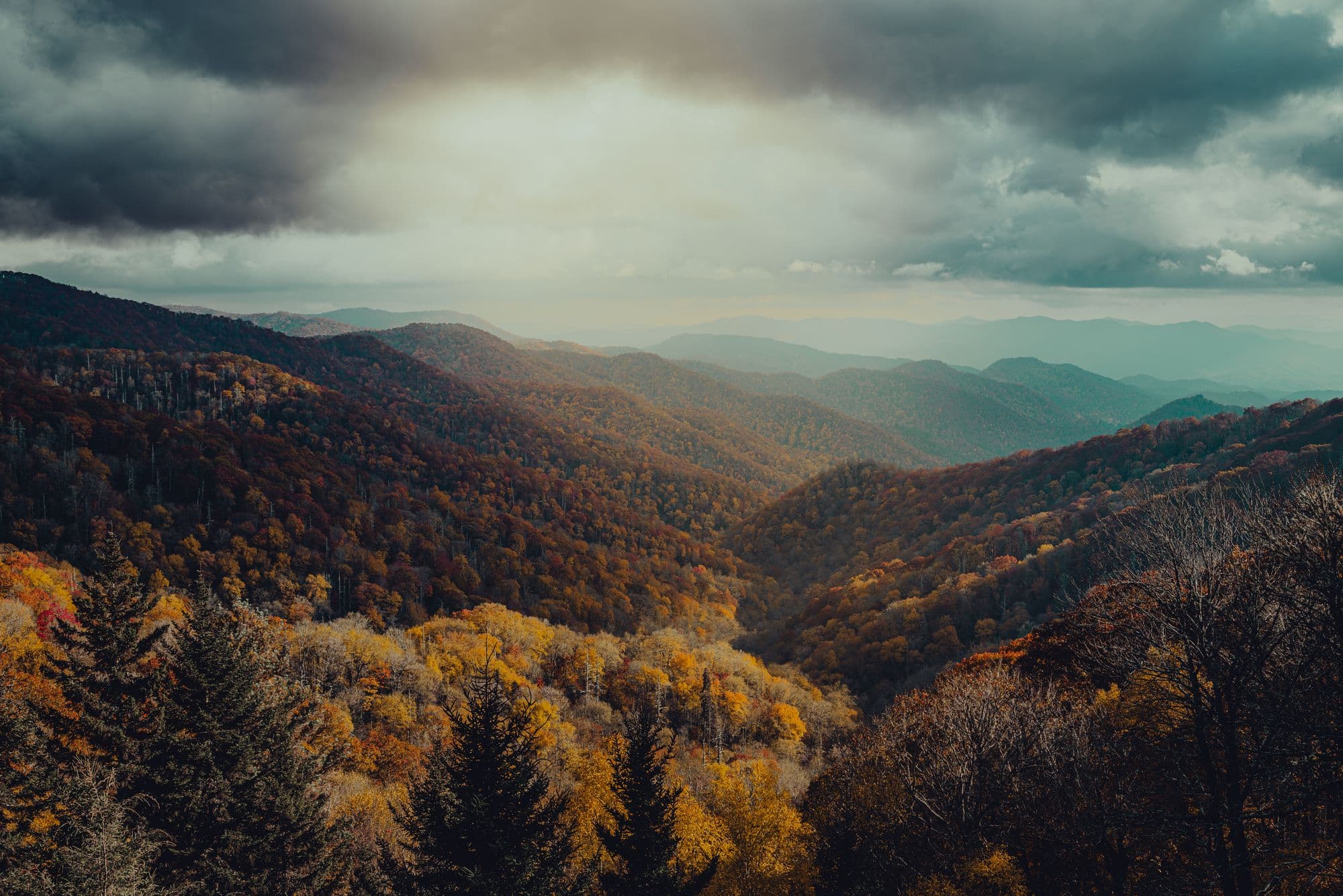
The color near Greenville usually lags the color on top of the mountain, because elevation drives the calendar more than the date on it does. The National Park Service, which manages the Blue Ridge Parkway along the North Carolina line, says fall color starts at the parkway's highest elevations as early as late September, then spreads down the mountainside through October as lower bands of elevation take their turn. Caesars Head State Park, the closest mountain overlook to Greenville, sits at 3,208 feet above sea level, according to South Carolina State Parks, well below the parkway's named peaks. Its color generally follows later in that same progression, which is why a Greenville weekend that still looks green can coincide with a full-color weekend an hour up US 276.
When does fall color peak in the Upstate?
Nobody can tell you the exact weekend before it happens, including the agencies that watch it for a living. The Park Service is specific about why: color timing depends on "complex environmental factors, as well as the genetic makeup of the plants themselves," and the best color needs a particular run of weather, bright sunny days, cool but not freezing nights, and rainfall that was adequate but not excessive over the summer. A hot, dry September or a wet, cloudy October changes the display, not just the date.
What does hold steady is the order. The highest elevations turn first, in late September, and color then spreads downhill through October. Caesars Head, at 3,208 feet, sits well below the parkway's named peaks, so its turn generally comes later in that progression. Neither the Park Service nor the state parks publish an exact week for that; the Park Service instead posts a fall color update every Friday on its own social media during the season, which is a better check than a calendar guess. The practical version: if a trip up US 276 looks mostly green in early October, that is not a sign the season was skipped. It is a sign you are early.
Where can you see fall color near Greenville without a long hike?
Caesars Head State Park's main overlook sits a short walk from the parking lot and looks out across the Blue Ridge Escarpment into North Carolina and Georgia on a clear day. Discover South Carolina, the state's own tourism office, lists it alongside two other easy stops worth the detour: Bald Rock, about five miles past Caesars Head on US 276, described as a mostly flat walk to a wide view, and Sassafras Mountain, the state's highest point, which has a paved path up to its observation tower. The same list names Wigington Overlook on the Oscar Wigington Scenic Byway and Jumping Off Rock in the Jim Timmerman Natural Resources Area for anyone willing to go further into Pickens and Oconee counties.
What is the drive from Greenville to Caesars Head State Park like?
US 276 leaves Greenville heading north, runs through downtown Travelers Rest, continues through Marietta, and then climbs into the foothills to Caesars Head on the Geer Highway. That climb is the entire reason the color at the top does not match the color in your front yard on the same day. The same road crosses through more than one week of the season on the way up, which makes it a genuinely different trip depending on which week you take it.
Do South Carolina's mountain state parks charge to get in?
Yes, at all three: South Carolina State Parks lists Caesars Head, Table Rock and Jones Gap as part of the fee-supported trail system, with a modest per-person charge at the trailhead and a lower rate for South Carolina seniors and young children. None of the main overlooks or trails need advance booking. The tradeoff is parking, not admission: the lots at the best-known overlooks fill by mid-morning on a sunny fall Saturday, and once they are full, the next option is turning around and finding somewhere else.
Which hike pairs well with a fall color drive from Greenville?
If you want to walk further than the overlook, Caesars Head's Raven Cliff Falls Trail is a four-mile round trip to a 420-foot waterfall that carries its own fall color along the way. Table Rock State Park's own staff recommend saving its Pinnacle Mountain Trail for late autumn and early winter, specifically because the mountain views the summer canopy blocks open up once most of the leaves are down, which is a different kind of payoff than catching color at its peak. Jones Gap State Park, next door to Caesars Head in the same Mountain Bridge Wilderness Area, has Rainbow Falls, a 120-foot cascade reached by a longer and harder trail.
The honest part: none of this can be scheduled precisely. A drive timed for "peak weekend" based on a guess can just as easily land a week early or a week late, and the parks themselves will not promise otherwise. The more reliable plan is the one Table Rock's own staff follow: pick a park and a trail for what it offers at a given point in the season. Early color at elevation shows up in late September. Open views after the leaves are down show up in late autumn and early winter. Chasing one perfect weekend that may not match your calendar is the harder way to do this.