Swamp Rabbit Trail, end to end, and what it connects
An old rail bed turned greenway, from Travelers Rest through Furman and Falls Park toward Greenville Tech. Length, surface, trailheads and parking.

Quick answers
- How long is the Swamp Rabbit Trail?
- There is no single length, because the sources count different things. Greenville County Parks, Recreation and Tourism calls it a 32 mile and growing network. Rails-to-Trails Conservancy's TrailLink measures 28.2 miles across all the pieces, with a longest continuous run of 17.7 miles from Tate Road north of Travelers Rest to Cleveland Street at South Pleasantburg Drive. That continuous run is the useful number.
- Where does the Swamp Rabbit Trail go?
- The Prisma Health Swamp Rabbit Trail runs the length of Greenville County, from Travelers Rest in the north, through Furman University and downtown Greenville, then south toward Greenville Technical College and Conestee. South of downtown the network splits. The Blue Line runs from Greenville Technical College toward Conestee Nature Preserve, and the Green Line carries the extensions toward Simpsonville and Fountain Inn.
- Is the Swamp Rabbit Trail hilly?
- No. The trail follows the former right of way of the Greenville and Northern Railway, and a rail grade climbs and falls only as much as a train could stand, which is not much. The surrounding Upstate terrain does considerably more than that. The corridor stays gentle from Travelers Rest through downtown Greenville.
- Where can you park to get on the Swamp Rabbit Trail?
- TrailLink lists parking at Gateway Park, 115 Henderson Drive in Travelers Rest, at Furman University, 3300 Poinsett Highway, at 150 Cleveland Park Drive in Greenville, and off Verdae Boulevard. The lots at the popular access points fill on weekend mornings, so starting from a less obvious trailhead and riding toward the busy end works better. Greenville County Parks publishes an interactive map of access points.
- Is the Swamp Rabbit Trail paved?
- The surface is asphalt with boardwalk sections, and TrailLink lists the trail as open to biking, walking and inline skating and as wheelchair accessible. It is one path rather than separated lanes, so a bicycle moving at speed and a person walking a dog share the same pavement. The stretch between Falls Park and Cedar Lane is busier on a Saturday morning than on a Tuesday afternoon.
- What is it like to live on the Swamp Rabbit Trail?
- A house on the trail sits on a public path. Foot and bicycle traffic starts early in the morning, the corridor is lit in some sections and not in others, and a back yard that opens onto a busy stretch has people passing a few feet from the fence line at six in the morning. A house a block off the trail is a different search with different inventory.
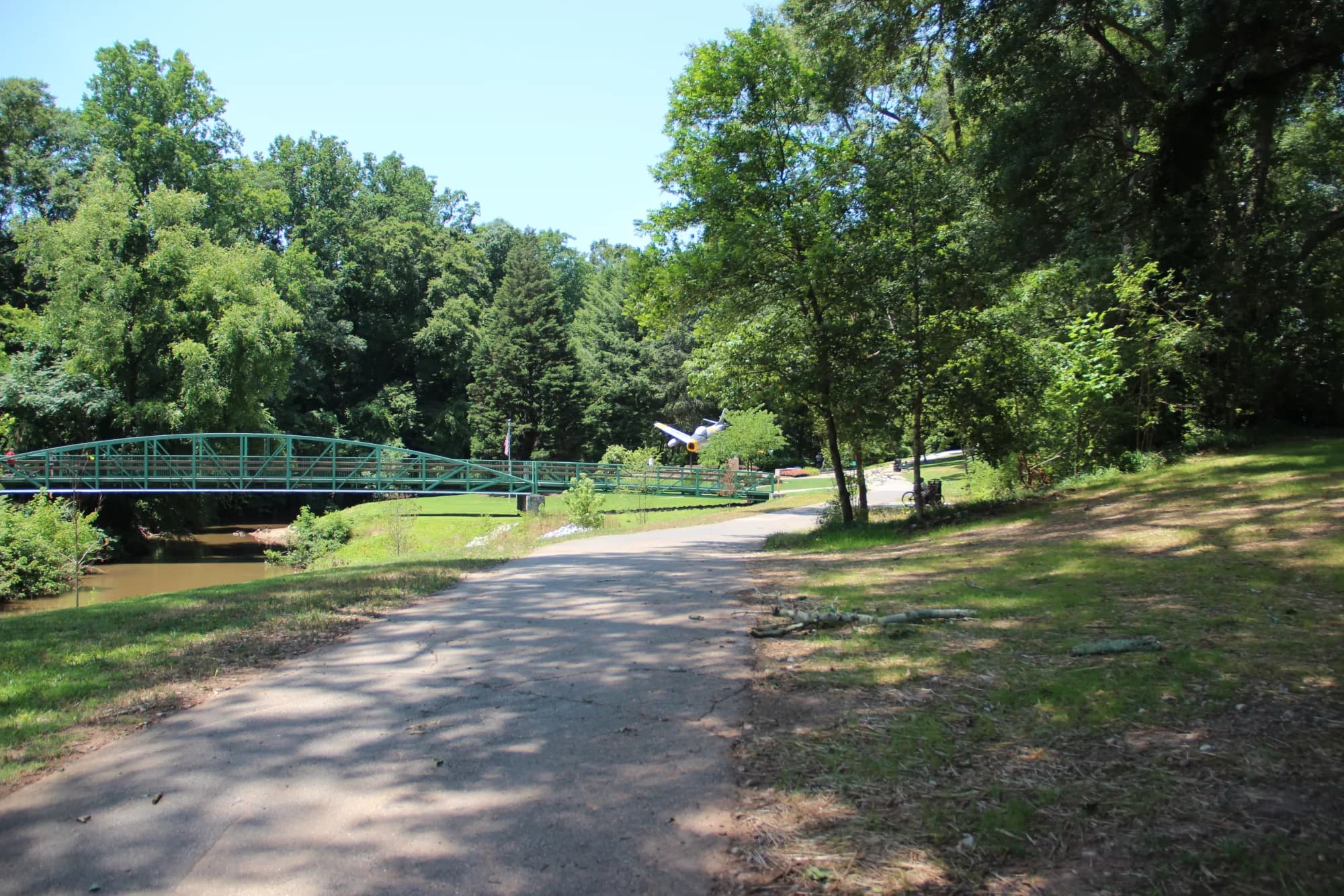
The Prisma Health Swamp Rabbit Trail is a paved greenway built on the bed of a retired railroad, and it runs the length of Greenville County from Travelers Rest in the north, through Furman University and downtown Greenville, and south toward Greenville Technical College and Conestee. A greenway is a public path built for walking and biking. Greenville County Parks, Recreation and Tourism describes the whole thing as a 32 mile and growing network that has been open since 2009 and now reaches Fountain Inn, Greenville, Travelers Rest, Simpsonville and Mauldin. The continuous part, which is what most people mean when they say the Swamp Rabbit, is shorter than that.
How long is the Swamp Rabbit Trail?
The Swamp Rabbit Trail has no single length, because each source counts a different part of the network. Greenville County Parks, Recreation and Tourism counts a 32 mile network. The City of Travelers Rest describes a 22 mile multi-use greenway running along its Main Street and connecting to Greenville. Rails-to-Trails Conservancy's TrailLink measures 28.2 miles across all the pieces, with a longest continuous run of 17.7 miles from Tate Road north of Travelers Rest down to Cleveland Street at South Pleasantburg Drive. Furman University's own site calls it 28 miles.
They are all describing the same trail, and they disagree honestly. The network keeps adding spurs and lines while the connected middle stays roughly where it is. If you want the useful number, take the 17.7 mile continuous run. Travelers Rest sits at the north end of it and downtown Greenville sits roughly in the middle.
Is the Swamp Rabbit Trail hilly?
The trail follows the former right of way of the Greenville and Northern Railway, a short line that ran north out of Greenville from the late 1800s, according to the City of Travelers Rest. The railway picked up the swamp rabbit name from the wetlands of the upper Reedy River that its route crossed, and the trail kept it.
A rail grade is a gentle grade, and that is the practical consequence for anyone riding or walking it. The trail climbs and falls the way a train could stand to, which is not much, over a distance where the surrounding Upstate terrain does considerably more than that.
Where does the Swamp Rabbit Trail go?
At the north end the trail comes down from Tate Road into Travelers Rest, where it runs along Main Street. That stretch has benches and gazebos, a 1947 Southern Railway car parked near Sulphur Springs Road with a bike repair station beside it, and Main Street businesses within a few steps of the pavement, including Sidewall Pizza Company, Whistle Stop at the American Cafe, Pink Mama's Ice Cream Parlor and Topsoil Kitchen and Market. Sunrift Adventures rents bikes at 1 Center Street.
South of Travelers Rest the trail runs straight through Furman University's campus. Furman's own site says the trail can be ridden or walked directly from campus into Travelers Rest or into downtown Greenville, which is a fair description of where the campus sits on the line. Closer in, the trail follows the Reedy River through Greenville's west end. TrailLink's route notes Unity Park, Linky Stone Park, Falls Park on the Reedy, Cancer Survivors Park and Holland Park along this stretch, plus a pedestrian bridge over the Reedy and what it calls South Carolina's first diagonal pedestrian crossing with a bike signal. Swamp Rabbit Cafe and Grocery sits directly on the trail at 205 Cedar Lane Road, open daily from 7:30 in the morning until 8 at night, and the South Carolina Department of Agriculture lists it as a certified roadside market selling local produce, meat, dairy and eggs alongside the bakery and kitchen.
South of downtown Greenville the network splits. Greenville County's Blue Line runs from Greenville Technical College toward Conestee Nature Preserve, with a Mauldin segment that crosses I-385, and the Green Line carries the extensions toward Simpsonville and Fountain Inn.
Is the Swamp Rabbit Trail paved?
The Swamp Rabbit Trail is asphalt with boardwalk sections, according to TrailLink, which lists it as open to biking, walking and inline skating and as wheelchair accessible. It is one path, not separated lanes, so a bicycle moving at speed and a person walking a dog share the same pavement.
That matters more at some hours than others. The stretch between Falls Park and Cedar Lane in Greenville on a Saturday morning is a different experience from the same stretch on a Tuesday afternoon, and anyone who plans to use the trail for commuting rather than exercise should ride it once at that hour.
Where can you park to get on the Swamp Rabbit Trail?
TrailLink lists parking at Gateway Park at 115 Henderson Drive in Travelers Rest, at Furman University at 3300 Poinsett Highway, at 150 Cleveland Park Drive in Greenville, and off Verdae Boulevard. Greenville County Parks, Recreation and Tourism publishes an interactive map of the network showing access points and parking. Check it before a first trip, because the lines are still being extended and the map moves.
The lots at the popular access points fill on weekend mornings. The unglamorous fix is to start from a less obvious trailhead and ride toward the busy end rather than parking at it.
What is it like to live on the Swamp Rabbit Trail?
Buyers ask for proximity to the Swamp Rabbit Trail by name, particularly in Travelers Rest and on the west side of Greenville. It is one of the few amenities in Greenville County that people will name unprompted on a first call, along with a commute time and a school district.
The honest part is what it means to live on the trail rather than near it. The trail is a public path. It carries foot and bicycle traffic from early morning, it is lit in places and not in others, and a back yard that opens onto a busy section has people passing a few feet from the fence line at six in the morning. Some buyers love that and specifically ask for it. Others tour one of those houses and immediately revise the request to a house a block off the trail, which is a different search with different inventory.
Filtering a search down to the trail also narrows the list hard. In our own searching, on or beside the trail returns a short list in any given month, because the corridor is a fixed line and few Greenville County houses touch it. That is worth knowing before you build a whole search around it.